UK Coastal Safety Infrastructure · Patent GB2629638B
Making the Invisible…
Visible
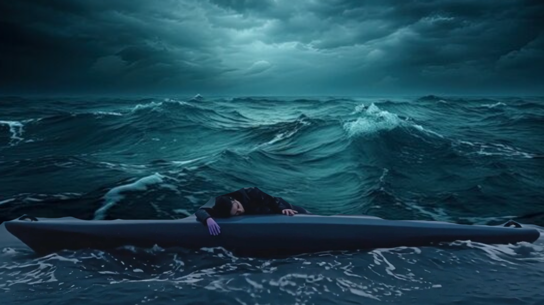
Every day, thousands of kayakers, paddleboarders, paramotor pilots, and small vessel operators enter UK coastal waters carrying nothing but a smartphone.
To the RNLI crews sworn to protect them, they are invisible. No AIS signal. No float plan. No electronic trace.
This is not a technology failure. It is an infrastructure gap. And it costs lives.
Patent GB2629638B — Granted July 2025SafeTrx Closed 31 Dec 2025 — No ReplacementCPAS: Making the Invisible VisibleFirst Live Ping: 16 April 2026 · Shoreham Sailing ClubNewhaven–Shoreham Feasibility Study — Now OpenNo Hardware · No Transponders · Any SmartphonePatent GB2629638B — Granted July 2025SafeTrx Closed 31 Dec 2025 — No ReplacementCPAS: Making the Invisible VisibleFirst Live Ping: 16 April 2026 · Shoreham Sailing ClubNewhaven–Shoreham Feasibility Study — Now OpenNo Hardware · No Transponders · Any Smartphone
The Problem
An Infrastructure Gap. Not a Tech Gap.
Every day, thousands of kayakers, paddleboarders, paramotor pilots, and small vessel operators enter UK coastal waters carrying nothing but a smartphone.
To the RNLI crews sworn to protect them, they are invisible. No AIS signal. No float plan. No electronic trace. When something goes wrong, the search begins from the last place someone saw them — not from verified, real-time position data.
This is not a technology failure. It is an infrastructure gap. And it costs lives.
On 31 December 2025, RYA SafeTrx — the UK's only government-endorsed coastal tracking platform — closed permanently. Over 13,000 registered users lost their safety net overnight. Thousands remain without a viable replacement today.
Dark Targets — Invisible to AIS
Kayakers & Canoeists
Stand-Up Paddleboarders
Paramotor Pilots
Paragliders & Hang-Glider Pilots
Wild Swimmers
Small Sailing Vessels (sub-AIS)
BVLOS Drone Operations
Hill Walkers in Remote Terrain
No current alternative integrates with RNLI operational systems. None make coastal users visible to commercial shipping traffic.
How It Works
CPAS — Common Position Awareness System
CPAS turns the smartphone already in a coastal user's pocket into a verified, real-time safety presence on RNLI operational screens. No hardware. No transponders. No infrastructure cost. No barrier to adoption.
01
Live AIS + GPS Fusion
CPAS combines live AIS commercial traffic with mobile GPS position data from coastal users — rendered in a navigable 3D Digital Twin that shows every vessel, kayaker, and pilot in the same shared display, in real time.
02
A Living Volume, Not a Flat Map
Where traditional tracking shows a flat map, VIDEAR shows a living volume. A kayaker at sea level. A paramotor at 300 feet. A ferry entering the harbour mouth. All visible. All in one place.
03
Protected by Patent GB2629638B
The patented terrain-clamping methodology places every user accurately in 3D space using GNSS fused with barometric data and 2-metre LiDAR. No software alternative offers this capability.
CPAS Digital Twin — Operational View Live
KYK-001
AIS: FERRY
PMT-003 · 300ft
RNLI B-789
⚠ CPA ALERT: 0.3NM
CPAS User
AIS / RNLI
Aerial
CPA Alert
Why Now
The Window Is Open.
On 31 December 2025, RYA SafeTrx — the UK's only government-endorsed coastal tracking platform — closed permanently. Over 13,000 registered users lost their safety net overnight. Thousands remain without a viable replacement today.
No current alternative integrates with RNLI operational systems. None make coastal users visible to commercial shipping traffic. VIDEAR is the only platform built to close this gap — and the window to act is open right now.
Dec 2025
SafeTrx Closes
The UK's only government-endorsed coastal tracking platform closes permanently. 13,000 users have no replacement.
Mar 2026
CAP3217 Published
CAA formally acknowledges hardware EC is impractical for foot-launched pilots. The policy window for software-only solutions is officially open.
Now
VIDEAR is Ready
The technology is built. The patent is granted. The infrastructure is live. The corridor trial starts now.
Join Our Feasibility Study
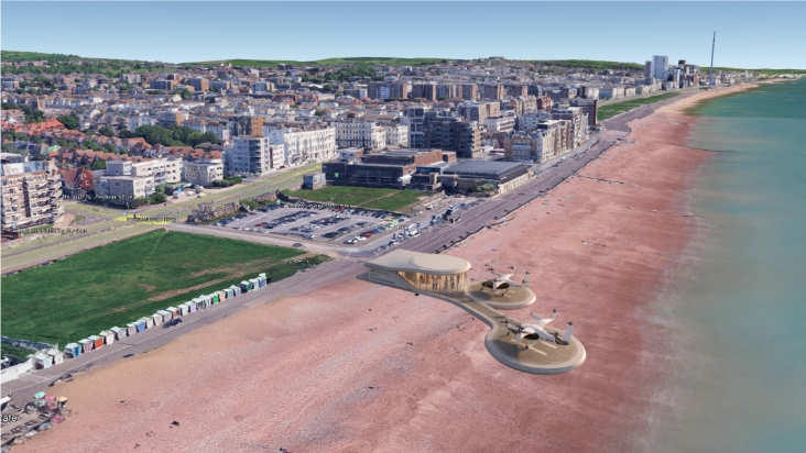
The Newhaven– Shoreham Corridor
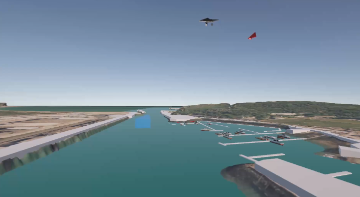
We are conducting a structured feasibility study across the Newhaven to Shoreham corridor — 14km of the UK's most diverse coastal traffic, spanning three active RNLI stations, two commercial ports, a working marina, and open cliff coastline and busy beaches.
We are looking for sailors, paramotor pilots, kayakers, SUP boarders, and small vessel operators to join our pilot cohort.
Register your interest now. Pilot cohort members receive free access for the full duration of the study.
Sailors & Yacht Clubs
Paramotor Pilots
Kayakers & Canoeists
SUP Boarders
Small Vessel Operators
Newhaven → Shoreham · 14km
Register Your Interest
Join the pilot cohort for the UK's first structured feasibility study of a software-only coastal position awareness platform. Free access for the full study duration.
Every day, thousands of people enter the UK's coastal waters, low-level airspace, and upland terrain electronically invisible to the systems designed to keep them safe.
Kayakers launching from harbour mouths. Paramotor pilots lifting off cliff tops. Sailors crossing busy shipping lanes. Hill walkers heading into remote terrain. To the rescue services responsible for finding them, these people leave no electronic trace.
When something goes wrong, the search begins blind.
The Scale of the Problem
Every Incident Begins the Same Way.
8,000+
RNLI Launches Per Year
The RNLI launches over 8,000 times every year. The overwhelming majority involve people with no means of transmitting their position — no AIS signal, no float plan, no verified last-known location.
1,500+
Mountain Rescue Incidents Annually
Mountain Rescue England and Wales responds to more than 1,500 incidents annually. Every one of those incidents begins the same way: rescuers searching for someone they cannot see.
13,000
SafeTrx Users Without Replacement
When SafeTrx closed in December 2025, 13,000 registered users lost their safety net overnight. As of today, there is no named replacement endorsed by the MCA.
170K
Dark Coastal Vessels in UK Waters
Estimated dark coastal vessels represent entirely unquantifiable risk — no trajectory data, no incident correlation, no verified identity. Invisible to every current system.
The VIDEAR Solution
Software Only. Zero Hardware. Real Time.
CPAS — the Common Position Awareness System — is a patented, software-only platform that makes previously invisible users visible in a live 3D Digital Twin environment, in real time, on the devices rescue crews already carry.
No hardware. No transponders. No infrastructure investment required.
A smartphone in a kayaker's pocket becomes a verified, trackable presence on an RNLI operational screen. A paramotor pilot at 300 feet appears as a distinct, altitude-accurate icon — distinguishable from a swimmer at sea level in the same horizontal coordinates. A hill walker's last confirmed position becomes the search datum if their Heartbeat signal is lost.
This capability is protected by UK Patent GB2629638B — the only software solution that resolves position across three dimensions in real-time, across maritime, airspace, and land environments simultaneously.
3D Digital Twin — Operational View Active
SEA LEVEL
VESSEL
300ft
HILLWALKER
⚠ CPA: COLLISION RISK
Maritime
Aerial / Upland
AIS Vessel
Alert
Where We Are
Not Yet at Public Launch. But Live.
VIDEAR is currently conducting a structured feasibility study across the Newhaven to Shoreham coastal corridor — three active RNLI stations, two commercial ports, a working marina, and 14km of the UK's most diverse coastal traffic.
We are not yet at public launch. But the digital twin is being built, the corridor will soon be active, and the institutional conversations are underway.
First live CPAS position ping recorded: 16 April 2026, 11:20 UTC
Lat 50.7947 · Lon 0.0561 · Asset: CPASIcon_Kayak_001 · Club: Shoreham Sailing Club
For Safety & Rescue Organisations
We Would Welcome A Conversation
If you are from the RNLI, MCA, CAA, DASA, Mountain Rescue England and Wales, Search and Rescue Scotland, or the broader maritime safety and insurance sector — we would welcome a conversation.
VIDEAR aligns directly with DASA's Rapid Impact programme, delivering dual-use capability across SAR and littoral force protection — scalable from the Newhaven–Shoreham corridor to the full UK coastline.
VIDEAR Solutions
CPAS — Common Position Awareness System
CPAS is VIDEAR's flagship platform — a complete common visibility solution designed for the RNLI, MCA, and UK coastal communities.
It addresses the single most dangerous gap in UK maritime safety: the 80% of coastal activity entirely invisible to the systems designed to protect it. CPAS creates the Common Operating Picture that RNLI crews, coastguard operators, port controllers, and drone teams all need — and that currently does not exist anywhere in the UK.
The pilot deployment runs across the Newhaven-to-Shoreham corridor: 14km encompassing commercial port traffic, cliff-edge paramotor activity, high-density beach users, and three active RNLI stations. If it works here, it works everywhere.
Who CPAS Serves
Built for the Professionals Who Save Lives
RNLI & SAR Operations
Precision Recovery. Not a Wide-Area Hunt.
CPAS transforms search and rescue from a wide-area visual hunt into a precision recovery mission.
When a casualty is reported, CPAS replays their last known trajectory, establishes their Last Known Position to within metres, and presents the responding crew with a direct recovery vector — even when the casualty is hidden below wave height.
CPAS also provides the airspace deconfliction layer that the RNLI's drone programme requires for routine BVLOS operations. By making paramotor pilots and other aerial dark targets electronically visible, CPAS gives the CAA the data it needs to authorise drone deployment across coastal corridors.
Port Authorities
VTS Integration. No New Hardware.
Port controllers at Newhaven, Shoreham, and facilities across the UK face real liability when recreational users enter commercial shipping approaches undetected — a kayaker invisible to radar, a paddleboarder crossing a ferry lane, a small fishing vessel with no AIS signal.
CPAS addresses this through direct VTS integration. Anonymous position data from all active CPAS users in the port approaches is delivered via API into existing Vessel Traffic Service displays — giving port controllers a complete common operating picture of both commercial AIS traffic and recreational users simultaneously, in real time.
When a recreational user is detected in a sensitive approach zone, the VTS operator can alert commercial traffic by VHF radio in the normal operational way. No change to existing bridge procedures. No new hardware on commercial vessels. Just the information that was previously missing, delivered to the people already responsible for managing it.
Available on a monthly subscription basis per port. No hardware installation required.
Insurance Sector
Actuarial Data for Unquantified Risk.
170,000 dark coastal vessels represent entirely unquantifiable risk in the current maritime insurance market. No trajectory data. No incident correlation. No verified identity. Premiums are estimated, not calculated.
CPAS Level 3 verified users — with registered hull IDs and club vouchers — provide the actuarial data insurers need to price small-vessel risk with genuine precision.
A verified user receiving a 10% premium discount makes their VIDEAR subscription effectively free — creating a self-sustaining acquisition engine at no marketing cost.
Defence & Security
The Intentional Dark Becomes Visible.
The same visibility infrastructure that powers coastal safety is a force multiplier for UK littoral security.
By establishing a verified baseline of Known Good Actors, security assets can focus entirely on contacts carrying no CPAS registration signature. The Innocent Dark — 98% of recreational users — become transparent. The Intentional Dark become immediately identifiable.
VIDEAR aligns directly with DASA's Rapid Impact programme, delivering dual-use capability across SAR and littoral force protection scalable from the Newhaven–Shoreham corridor to the full UK coastline.
Get in Touch
Ready to See CPAS in Action?
Whether you represent RNLI, HM Coastguard, MCA, a port authority, insurer, or defence stakeholder — we want to hear from you.